Weather warning issued for Harrogate District as Storm Gareth set to blow in 65mph winds


The Met Office has extended an initial warning for the south and midlands to take in the north of England as a spell of strong northwesterly winds make their way toward Britain.
Heavy rain showers and gale force winds are expected when an area of deep low pressure tracks across the country. The intense low is expected to move eastwards during the early part of the week and has been named as Storm Gareth by Met Eireann, the Irish Met Office.
Advertisement
Hide AdAdvertisement
Hide AdA strong jet stream is continuing to speed across the Atlantic with deep areas of low pressure moving close to the UK bringing the periods of windy weather.
Gusts are expected to be between 50 and 55mph in the main, however, some could reach up to 65mph, especially on high ground and along the western coast.
Met Office Chief Meteorologist, Paul Gundersen, said: “The strong north-westerly winds will also affect southwest Scotland late on Tuesday, spreading across much of England and Wales through Wednesday. Gusts of 50-55 mph are likely inland and up to 65 mph along western coasts. Winds will gradually ease during the afternoon.”
Advertisement
Hide AdAdvertisement
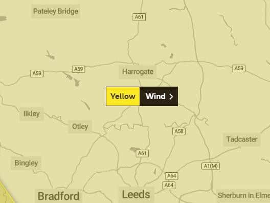
Hide AdIn addition to the strong winds, Storm Gareth will bring some heavy rain for parts of the UK overnight Monday into Tuesday, particularly across northern England where a yellow warning for rain is in place from midnight tonight to midday tomorrow (Tuesday). 20-40 mm of rainfall is expected quite widely with 50-60 mm possible over higher ground in Cumbria.
As Storm Gareth moves away from the UK, the winds will ease and the rest of the week will remain unsettled with showers or spells of rain, and some brief drier interludes. Although temperatures will be near average for the time of year it will often feel colder due to the strong winds.
These are the 12 foods which we would usually consider healthy but contain stacks of potentially harmful sugarWinds are expected to pick up considerably from about 9pm on Tuesday and continue to cause disruption right through to 3pm on Wednesday, although we are expected to see conditions gradually ease during the afternoon.
The Met Office website states: "Strong northwesterly winds are expected during Tuesday night and Wednesday with possible transport disruption. Delays for high-sided vehicles on exposed routes and bridges likely. Some short term loss of power and other services is possible. It's likely that some coastal routes, sea fronts and coastal communities are affected by spray and/or large waves."