Good news for Harrogate motorists as date is confirmed for major Kex Gill landslip repairs
and live on Freeview channel 276
North Yorkshire Council has confirmed it has appointed contractors to complete a £750,000 repair scheme.
There will be extended hours and night working to allow the road to be re-opened before the end of June.
Advertisement
Hide AdAdvertisement
Hide AdThe road, which runs across a rural stretch of the county on the edge of the Yorkshire Dales National Park, is deemed a nationally important strategic route, providing a key link running across the country.


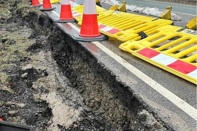
The route closed in February after a crack appeared in the verge as a result of poor weather over the past few months.
February was one of the wettest on record and the persistent rainfall has continued to make the situation worse, with further movement since the start of the closure – something that has been substantiated by geologists.
Kex Gill has a history of landslips, so a multi-million pound scheme has been launched to create a new three-mile stretch of road.
Advertisement
Hide AdAdvertisement
Hide AdHowever, the existing road had to be closed again after the latest landslip.
North Yorkshire Council’s corporate director of environment, Karl Battersby, said: “We have reached a point where we can appoint a contractor and decide on the most efficient and cost-effective repair scheme, with preparatory work now underway.
“There have been more than 10 landslips on the A59 at Kex Gill, between Church Hill and North Moor Road, so the ongoing re-alignment scheme is needed now more than ever.
“The repairs will include driving long sheets of steel into the ground to create a structural wall.
Advertisement
Hide AdAdvertisement
Hide Ad"Once this has been completed, contractors will fill in the excavated area between the steel sheets and the road to provide strength and stability.
"Relocating communications cables and completing drainage and resurfacing works once the area is filled also forms part of the scheme.
“Until the road is re-opened, we advise road users to follow the signed diversion route."
For more details of the diversion route, visit the web map: https://www.northyorks.gov.uk/roads-parking-and-travel/roads-and-pavements/roadworks-map