Harrogate escapes the worst of Storm Diana as 80mph winds bring chaos to parts of UK


An update to the alert has confirmed that the worst of the weather should have passed the region by 5pm on Thursday with winds reducing in speed to a maximum of around 35mph.
Advertisement
Hide AdAdvertisement
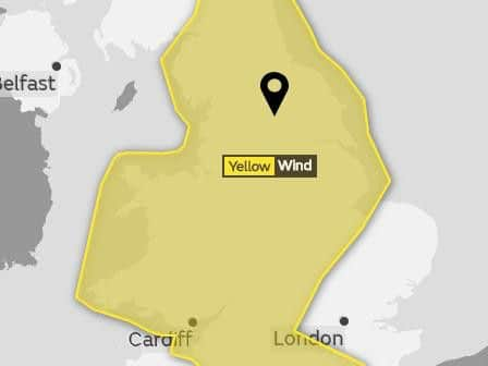
Hide AdThe Met Office issued a Yellow Warning on Wednesday evening following fears that Storm Diana could wreak havoc with 70mph winds and torrential rains sweeping across Yorkshire and the Harrogate district.
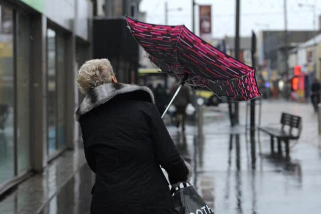
However, despite some strong gusts bringing down branches and the odd heavy downpour, it seems that Harrogate and the surrounding areas have escaped the very worst of the conditions.
There are still some warnings in place for the Yorkshire coast with the Environment Agency issuing a Flood Alert for Bridlington due to a giant sea swell.
Advertisement
Hide AdAdvertisement
Hide AdAcross the country, Diana struck with severe force, bringing 80mph gales and leaving 43,000 homes without power in Ireland and South West England. Threat-to-life warnings had been put in place as the powerful weather system approached the UK.
Gusts of 89mph were recorded in Capel Curig, north Wales; 76mph in Aberdaron; 70mph in Aberporth; 68mph in Lake Vyrnwy, mid-Wales; 47mph Bala; 50mph Belfast; 58mph Milford Haven; 52mph Mumbles, Swansea; 58mph in Plymouth and 60mph in Culdrose on Wednesday,
Crews from Shell's Brent Charlie North Sea oil rig platform needed to be rescued as they were lashed with the wind and rain. It is thought 135 members of the staff were taken off the rig, leaving only 48 essential employees on board.
Advertisement
Hide AdAdvertisement
Hide AdAirports including Heathrow, Manchester, Birmingham and Edinburgh cancelled dozens flights due to high winds - with travel firms warning customers to check with their providers.
The Met Office's latest alert states that there will be some windy weather across Harrogate but that it will not be as severe as elsewhere in the country.
"Continuing windy Thursday evening and overnight with occasional blustery showers, these will be heaviest and most frequent over the hills," a spokesman said. "The best of any drier and clearer spells will be in the east, but it will feel colder.
"Friday will still be windy, but with bright or sunny spells and occasional blustery showers. The cloud and rain will start to clear by Saturday, but it will be feeling chilly. On Sunday, morning rain should clear to a brighter afternoon."